 vesseltracker.com
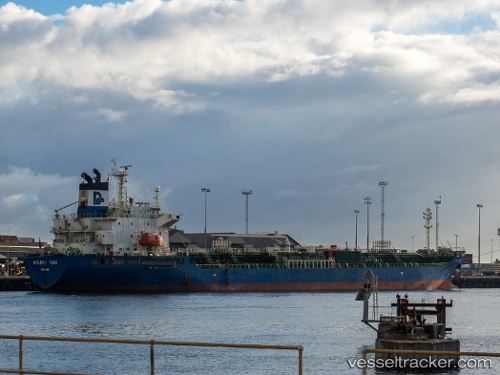
Vessel CNC DREAM IMO: 9305544, MMSI: 440047000 Chemical/Oil Products Tanker
UTC, 31.13310, 123.14275, course: 38, speed: 0.1
UTC, 31.13445, 123.14160, course: 79, speed: 0.2
2026-02-23 04:05:05 UTC, 31.13722, 123.14195, course: 106, speed: 0.1
Live AIS position:
UTC. 33 nm NE of Lü-hua Shan),
updated 2026-02-23 04:05:05 UTC.
Find the position of the vessel CNC DREAM on the map. The latter are known coordinates and path.
marine traffic ship tracker show on live map
The current position of vessel CNC DREAM is 31.13722 lat / 123.14195 lng. Updated: 2026-02-23 04:05:05 UTCCurrently sailing under the flag of Korea (Republic of)
CNC DREAM built in 2004 year
Deadweight:
19773 tDetails:
Last coordinates of the vessel:
UTC, 31.13297, 123.14397, course: 14, speed: 0UTC, 31.13310, 123.14275, course: 38, speed: 0.1
UTC, 31.13445, 123.14160, course: 79, speed: 0.2
2026-02-23 04:05:05 UTC, 31.13722, 123.14195, course: 106, speed: 0.1