 vesseltracker.com
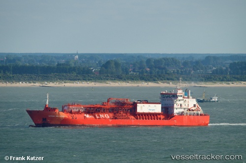
Vessel CORAL FRASERI IMO: 9378278, MMSI: 636022010 Combination Gas Tanker (LNG/LPG)|LNG Tanker
UTC, 38.62068, 0.31282, course: 210, speed: 10.1
UTC, 38.33331, 0.08801, course: 213, speed: 9.8
2026-02-09 01:57:04 UTC, 38.01116, -0.16816, course: 213, speed: 10.6
Live AIS position:
UTC. 23 nm SE of El Altet),
updated 2026-02-09 01:57:04 UTC.
Find the position of the vessel CORAL FRASERI on the map. The latter are known coordinates and path.
marine traffic ship tracker show on live map
The current position of vessel CORAL FRASERI is 38.01116 lat / -0.16816 lng. Updated: 2026-02-09 01:57:04 UTCCurrently sailing under the flag of Liberia
CORAL FRASERI built in 2010 year
Deadweight:
10441 tDetails:
Last coordinates of the vessel:
UTC, 38.88511, 0.56078, course: 225, speed: 8.8UTC, 38.62068, 0.31282, course: 210, speed: 10.1
UTC, 38.33331, 0.08801, course: 213, speed: 9.8
2026-02-09 01:57:04 UTC, 38.01116, -0.16816, course: 213, speed: 10.6