 vesseltracker.com
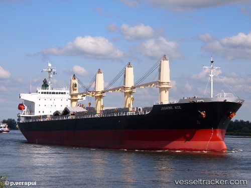
Vessel Callio IMO: 9310721, MMSI: 352112000 Bulk Carrier
UTC, 44.49133, -9.85620, course: 208, speed: 6.9
UTC, 44.29508, -10.02450, course: 222, speed: 6.3
2026-02-10 19:50:57 UTC, 44.11335, -10.19693, course: 223, speed: 6.5
Live AIS position:
UTC. 55 nm NW of Villanueva de Lorenzana),
updated 2026-02-10 19:50:57 UTC.
Find the position of the vessel Callio on the map. The latter are known coordinates and path.
marine traffic ship tracker show on live map
The current position of vessel Callio is 44.11335 lat / -10.19693 lng. Updated: 2026-02-10 19:50:57 UTCCurrently sailing under the flag of Panama
Callio built in 2006 year
Deadweight:
32946 tDetails:
Last coordinates of the vessel:
UTC, 44.72960, -9.67075, course: 218, speed: 7.3UTC, 44.49133, -9.85620, course: 208, speed: 6.9
UTC, 44.29508, -10.02450, course: 222, speed: 6.3
2026-02-10 19:50:57 UTC, 44.11335, -10.19693, course: 223, speed: 6.5