vessel TELI IMO: 9229295, Crude Oil Tanker vesseltracker.com
Vessel TELI IMO: 9229295, Crude Oil Tanker
MMSI: 352001253 callsign: 3E4002 size: 277x276

Find the position of the vessel TELI on the map. The latter are known coordinates and path.

marine traffic ship tracker show on live map

The current position of vessel TELI is 34.549 lat / 128.69 lng. Updated: 2024-04-26 08:13:08 UTC

Currently sailing under the flag of Panama

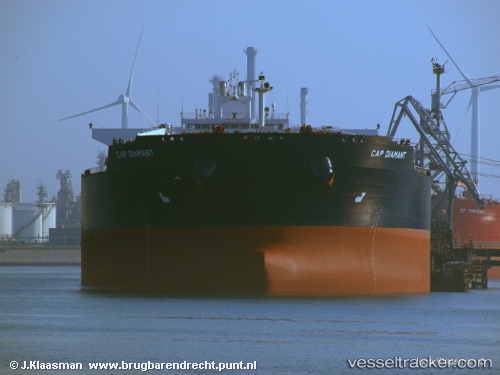
TELI built in 2001 year

Deadweight:
160044 t

Gross tonnage:
94729
Service entry:
2001-01-01T00:00:00Z

Manufacturer:
Hyundai Heavy Industries (company)

Details:


Last coordinates of the vessel:
UTC, 34.549, 128.69, course: 53, speed: 12.7
2024-04-26 08:13:08 UTC, 34.549, 128.69, course: 53, speed: 12.7

Track of the vessel in the last 14 days


Most frequent ports a vessels calls at TELI (352001253):

Sambu, traffic: 4
Sitrah Anchorage, traffic: 3
Port Said, traffic: 2
Ras Gharib, traffic: 2
Ra’S Shukhayr, traffic: 2
Singapore, traffic: 2
Bur Ibrahim, traffic: 2
Uskudar, traffic: 2
Fujairah, traffic: 2
Piraeus, traffic: 2
Jeddah, traffic: 1
Istanbul, traffic: 1
Nantong, traffic: 1
Jiddah, traffic: 1

Link to the map:


Find another ship

TELI (352001253) last ports (portcalls and passsages)

Jeddah | 2023-10-24 22:42:08
Nantong | 2023-10-10 11:12:38
Sitrah Anchorage | 2022-06-10 16:44:31
Sitrah Anchorage | 2022-05-29 13:57:17
Sitrah Anchorage | 2022-02-24 12:52:55
Singapore | 2022-01-30 17:05:33
Sambu | 2022-01-29 17:05:56
Fujairah | 2022-01-08 13:45:03
Ra’S Shukhayr | 2021-12-23 04:46:52
Ras Gharib | 2021-12-23 03:06:41
Bur Ibrahim | 2021-12-22 17:27:58
Port Said | 2021-12-22 07:15:20
Piraeus | 2021-12-17 22:36:21
Uskudar | 2021-12-13 13:35:15