 vesseltracker.com
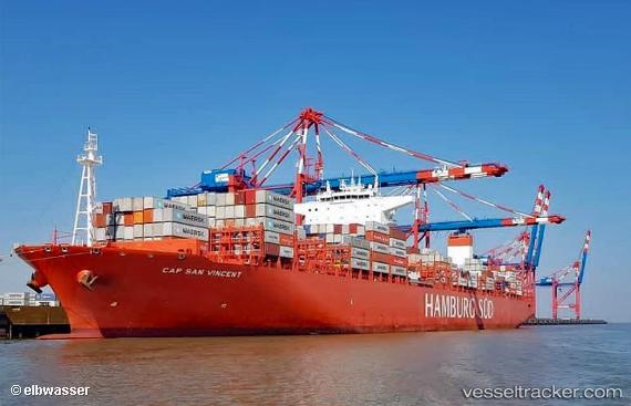
Vessel Cap San Vincent IMO: 9717228, MMSI: 538008133 Container Ship
UTC, -27.45980, -33.36878, course: 99, speed: 15.6
UTC, -27.57565, -32.58052, course: 97, speed: 15.7
2026-02-07 14:31:53 UTC, -27.66417, -31.96577, course: 97, speed: 16.1
Live AIS position:
UTC. 371 nm SE of Bela Vista),
updated 2026-02-07 14:31:53 UTC.
Find the position of the vessel Cap San Vincent on the map. The latter are known coordinates and path.
marine traffic ship tracker show on live map
The current position of vessel Cap San Vincent is -27.66417 lat / -31.96577 lng. Updated: 2026-02-07 14:31:53 UTCCurrently sailing under the flag of Marshall Is
Details:
Last coordinates of the vessel:
UTC, -27.37447, -33.94348, course: 100, speed: 15.8UTC, -27.45980, -33.36878, course: 99, speed: 15.6
UTC, -27.57565, -32.58052, course: 97, speed: 15.7
2026-02-07 14:31:53 UTC, -27.66417, -31.96577, course: 97, speed: 16.1