 vesseltracker.com
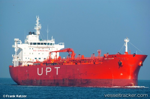
Vessel Cape Gavi IMO: 9391361, MMSI: 636019418 Chemical Oil Products Tanker
UTC, -24.17167, -46.35833, course: -1, speed: 0
UTC, -24.17251, -46.35873, course: 81, speed: 0.7
2026-03-04 07:35:15 UTC, -24.17333, -46.35667, course: -1, speed: 0
Live Vessel Cape Gavi Analytics (details, animations, etc.)
Live AIS position: UTC. 12 nm SW of Guarujá), updated 2026-03-04 07:35:15 UTC.Find the position of the vessel Cape Gavi on the map. The latter are known coordinates and path.
marine traffic ship tracker show on live map
The current position of vessel Cape Gavi is -24.17333 lat / -46.35667 lng. Updated: 2026-03-04 07:35:15 UTCCurrently sailing under the flag of Liberia
Cape Gavi built in 2008 year
Deadweight:
37606 tDetails:
Last coordinates of the vessel:
UTC, -24.17144, -46.35843, course: 111, speed: 0.2UTC, -24.17167, -46.35833, course: -1, speed: 0
UTC, -24.17251, -46.35873, course: 81, speed: 0.7
2026-03-04 07:35:15 UTC, -24.17333, -46.35667, course: -1, speed: 0