vessel Cape Washington IMO: 7826178, Vehicles Carrier
vesseltracker.com
Vessel Cape Washington IMO: 7826178, Vehicles Carrier
MMSI: 303932000 callsign: WRGH size: 237x32

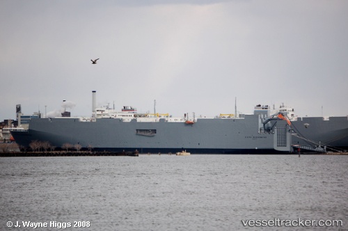
Find the position of the vessel Cape Washington on the map. The latter are known coordinates and path.

marine traffic ship tracker show on live map

The current position of vessel Cape Washington is 39.26251 lat / -76.60275 lng. Updated: 2025-02-14 03:22:34 UTC

Currently sailing under the flag of USA

Cape Washington built in 1982 year

Deadweight:
32695 t

Details:


Last coordinates of the vessel:
2025-02-14 03:22:34 UTC, 39.26251, -76.60275, course: 317, speed: 0

Track of the vessel in the last 14 days


Most frequent ports a vessels calls at Cape Washington (303932000):

Baltimore, traffic: 17
Port Arthur, traffic: 6
COVE POINT, traffic: 2
Annapolis, traffic: 2
Beaumont, traffic: 2
Flushing, traffic: 2
Port Neches, traffic: 2
Vlissingen, traffic: 2
DUNDALK, traffic: 1
Mobile, traffic: 1

Link to the map:


Find another ship

Cape_Washington (303932000) last ports (portcalls and passsages)

DUNDALK | 2025-02-14 03:26:50
COVE POINT | 2025-02-13 21:14:22
COVE POINT | 2025-02-08 21:26:38
Baltimore | 2024-06-12 17:51:51
Baltimore | 2024-03-26 20:29:10
Baltimore | 2024-02-04 20:10:27
Baltimore | 2024-01-31 19:05:34
Baltimore | 2023-09-22 00:09:49
Mobile | 2023-07-19 13:14:03
Baltimore | 2022-08-09 13:11:46
Baltimore | 2022-07-15 19:40:49
Baltimore | 2022-07-11 19:26:36
Baltimore | 2022-07-07 19:02:15
Baltimore | 2022-06-07 13:05:37
Baltimore | 2022-06-01 19:55:56
Baltimore | 2022-05-11 16:05:41
Baltimore | 2022-04-13 12:20:57
Annapolis | 2022-04-13 09:05:28
Vlissingen | 2022-03-27 18:05:21
Port Arthur | 2022-03-13 15:35:15
Beaumont | 2022-03-08 09:30:11
Port Neches | 2022-03-08 06:40:03
Port Arthur | 2022-03-08 06:25:01
Baltimore | 2021-12-01 00:00:52
Baltimore | 2021-09-30 16:11:49