vessel 419001655 IMO: 9315680, vesseltracker.com
Vessel 419001655 IMO: 9315680,
MMSI: 419001655 callsign: size: x

Find the position of the vessel 419001655 on the map. The latter are known coordinates and path.

marine traffic ship tracker show on live map

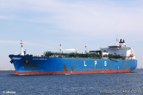
The current position of vessel 419001655 is 21.6933 lat / 65.4147 lng. Updated: 2024-04-26 20:54:43 UTC
Port of registry:
Nassau (capital city of the Commonwealth of the Bahamas)
Payload_mass:
58585 tonne
Gross tonnage:
47173
Service entry:
2006-01-01T00:00:00Z

Manufacturer:
Hyundai Heavy Industries (company)

Details:


Last coordinates of the vessel:
UTC, 21.9359, 64.9292, course: 117, speed: 13.7
UTC, 21.8759, 65.0476, course: 117, speed: 13.8
UTC, 21.8354, 65.1316, course: 117, speed: 13.7
2024-04-26 20:54:43 UTC, 21.6933, 65.4147, course: 118, speed: 14.2

Track of the vessel in the last 14 days


Most frequent ports a vessels calls at 419001655 (419001655):

Haldia, traffic: 7
Vishakhapatnam, traffic: 5
Mina Az Zawr, traffic: 4
Mina Abd Allah, traffic: 4
Mina Al Ahmadi, traffic: 4
Az Zarqa Island, traffic: 3
Mangalore, traffic: 3
Panamburu, traffic: 3
Sitrah Anchorage, traffic: 1

Link to the map:


Find another ship

419001655 (419001655) last ports (portcalls and passsages)

Mina Az Zawr | 2023-12-22 17:57:45
Haldia | 2023-12-08 14:11:15
Mina Az Zawr | 2022-12-13 11:27:32
Haldia | 2022-12-01 11:43:00
Vishakhapatnam | 2022-11-24 05:37:44
Panamburu | 2022-08-08 13:50:54
Mina Az Zawr | 2022-07-17 10:46:26
Mina Abd Allah | 2022-07-17 07:57:55
Haldia | 2022-07-05 07:25:58
Vishakhapatnam | 2022-06-25 05:01:13
Vishakhapatnam | 2022-06-20 10:25:24
Vishakhapatnam | 2022-06-16 07:10:32
Vishakhapatnam | 2022-06-12 04:43:13
Az Zarqa Island | 2022-06-01 07:06:03
Panamburu | 2022-05-12 13:18:50
Panamburu | 2022-05-08 07:29:47
Mina Abd Allah | 2022-04-25 18:40:17
Haldia | 2022-04-13 04:04:44
Az Zarqa Island | 2022-03-20 21:43:49
Haldia | 2021-12-16 16:14:26
Sitrah Anchorage | 2021-09-30 16:04:21