 vesseltracker.com
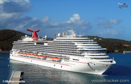
Vessel Carnival Breeze IMO: 9555723, MMSI: 354842000 Cruise Ship
UTC, 20.83000, -86.75500, course: -1, speed: 15
UTC, 20.50833, -86.98500, course: -1, speed: 7
2026-03-02 15:32:47 UTC, 20.47667, -86.97833, course: -1, speed: 0
Live AIS position:
UTC. Near COZUMEL),
updated 2026-03-02 15:32:47 UTC.
Find the position of the vessel Carnival Breeze on the map. The latter are known coordinates and path.
marine traffic ship tracker show on live map
The current position of vessel Carnival Breeze is 20.47667 lat / -86.97833 lng. Updated: 2026-03-02 15:32:47 UTCCurrently sailing under the flag of Panama
Carnival Breeze built in 2011 year
Deadweight:
10250 tDetails:
Last coordinates of the vessel:
UTC, 21.05500, -86.63333, course: -1, speed: 16UTC, 20.83000, -86.75500, course: -1, speed: 15
UTC, 20.50833, -86.98500, course: -1, speed: 7
2026-03-02 15:32:47 UTC, 20.47667, -86.97833, course: -1, speed: 0