 vesseltracker.com
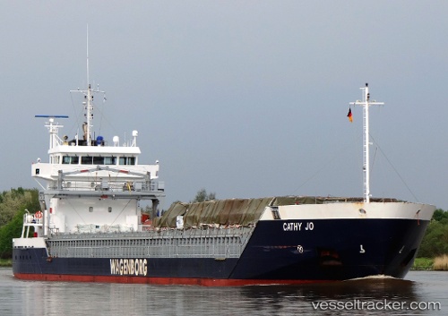
Vessel Cathy Jo IMO: 9419278, MMSI: 246996000 Multi Purpose Carrier
UTC, 51.07833, 1.88500, course: -1, speed: 0
UTC, 51.07833, 1.88333, course: -1, speed: 0
2026-02-15 18:14:16 UTC, 51.07983, 1.88472, course: 153, speed: 0.5
Live AIS position:
UTC. Near Calais),
updated 2026-02-15 18:14:16 UTC.
Find the position of the vessel Cathy Jo on the map. The latter are known coordinates and path.
marine traffic ship tracker show on live map
The current position of vessel Cathy Jo is 51.07983 lat / 1.88472 lng. Updated: 2026-02-15 18:14:16 UTCCurrently sailing under the flag of Netherlands
Details:
Last coordinates of the vessel:
UTC, 51.07833, 1.88667, course: -1, speed: 0UTC, 51.07833, 1.88500, course: -1, speed: 0
UTC, 51.07833, 1.88333, course: -1, speed: 0
2026-02-15 18:14:16 UTC, 51.07983, 1.88472, course: 153, speed: 0.5