 vesseltracker.com
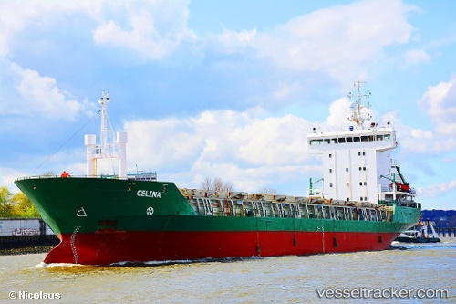
Vessel Celina IMO: 9019200, MMSI: 304099000 Multi Purpose Carrier
UTC, 59.62460, 24.72374, course: 96, speed: 8.5
UTC, 59.62460, 24.72374, course: 96, speed: 8.5
2026-02-05 00:21:41 UTC, 59.62460, 24.72374, course: 96, speed: 8.5
Live AIS position:
UTC. Near Nurme),
updated 2026-02-05 00:21:41 UTC.
Find the position of the vessel Celina on the map. The latter are known coordinates and path.
marine traffic ship tracker show on live map
The current position of vessel Celina is 59.62460 lat / 24.72374 lng. Updated: 2026-02-05 00:21:41 UTCCurrently sailing under the flag of Antigua Barbuda
Celina built in 2001 year
Deadweight:
5657 tDetails:
Last coordinates of the vessel:
UTC, 57.95018, 18.52080, course: 72, speed: 10.2UTC, 59.62460, 24.72374, course: 96, speed: 8.5
UTC, 59.62460, 24.72374, course: 96, speed: 8.5
2026-02-05 00:21:41 UTC, 59.62460, 24.72374, course: 96, speed: 8.5