vessel 'CENGIZ BEY' IMO: 9301342, vesseltracker.com
Vessel 'CENGIZ BEY' IMO: 9301342,
MMSI: 314460000 callsign: size: x

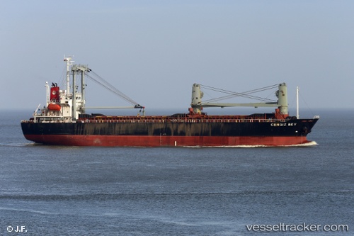
Find the position of the vessel 'CENGIZ BEY' on the map. The latter are known coordinates and path.

marine traffic ship tracker show on live map

The current position of vessel 'CENGIZ BEY' is 39.8419 lat / 42.8061 lng. Updated: 2024-04-20 13:59:12 UTC
Port of registry:
Avatiu
Payload_mass:
10308 tonne
Gross tonnage:
7823
Beam:
19.6 metre
Service entry:
2004-01-01T00:00:00Z
Details:


Last coordinates of the vessel:
UTC, 39.8419, 42.8061, course: -1, speed: 48
2024-04-20 13:59:12 UTC, 39.8419, 42.8061, course: -1, speed: 48

Track of the vessel in the last 14 days


Most frequent ports a vessels calls at 'CENGIZ BEY' (314460000):

Maassluis, traffic: 8
Vlaardingen, traffic: 6
Skagens Odde, traffic: 4
Limhamn, traffic: 4
Gelibolu, traffic: 2
Rotterdam, traffic: 2
Halsingborg, traffic: 2
Helsingborg, traffic: 2
Strait Of Gibraltar, traffic: 2
Helsingor, traffic: 2
Swinoujscie, traffic: 2
Szczecin, traffic: 2
Korsor, traffic: 2
Thessaloniki, traffic: 2
Land Skrona, traffic: 2

Link to the map:


Find another ship

'CENGIZ_BEY' (314460000) last ports (portcalls and passsages)

Uskudar | 2022-02-19 09:40:08
Gelibolu | 2022-02-19 00:20:39
Thessaloniki | 2022-02-12 00:20:16
Corinth Canal | 2022-02-08 21:50:23
Alexandria | 2022-01-22 14:45:54
Strait Of Gibraltar | 2022-01-14 18:58:32
Dover | 2022-01-09 17:00:58
Skagens Odde | 2022-01-07 01:00:06
Korsor | 2022-01-06 03:10:20
Swinoujscie | 2022-01-05 07:32:17
Szczecin | 2022-01-02 21:38:41
Limhamn | 2022-01-02 04:50:12
Limhamn | 2022-01-02 04:05:03
Land Skrona | 2022-01-02 02:40:03
Helsingborg | 2022-01-02 01:25:43
Skagens Odde | 2022-01-01 13:35:52
Maassluis | 2021-12-31 00:25:23
Vlaardingen | 2021-12-30 23:55:10
Vlaardingen | 2021-12-23 03:25:03
Vlaardingen | 2021-12-23 02:40:28
Dakar | 2021-12-01 00:00:24
Maltepe | 2021-09-30 16:10:09