 vesseltracker.com
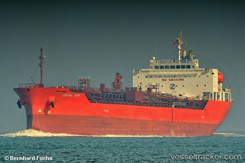
Vessel Central Park IMO: 9725823, MMSI: 636016933 Chemical Oil Products Tanker
UTC, 36.92176, -7.07460, course: 347, speed: 0.3
UTC, 36.94262, -7.05785, course: 335, speed: 0.9
2026-02-07 05:25:58 UTC, 36.95446, -7.03646, course: 327, speed: 1.2
Live AIS position:
UTC. 13 nm S of Punta Umbría),
updated 2026-02-07 05:25:58 UTC.
Find the position of the vessel Central Park on the map. The latter are known coordinates and path.
marine traffic ship tracker show on live map
The current position of vessel Central Park is 36.95446 lat / -7.03646 lng. Updated: 2026-02-07 05:25:58 UTCCurrently sailing under the flag of Liberia
Details:
Last coordinates of the vessel:
UTC, 36.92961, -7.03512, course: 253, speed: 3.4UTC, 36.92176, -7.07460, course: 347, speed: 0.3
UTC, 36.94262, -7.05785, course: 335, speed: 0.9
2026-02-07 05:25:58 UTC, 36.95446, -7.03646, course: 327, speed: 1.2