 vesseltracker.com
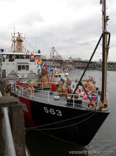
Vessel Cg Henry Blake IMO: 9177313, MMSI: 338922000 Buoy Lighthouse Vessel
UTC, 47.99186, -122.22439, course: 178, speed: 0.1
UTC, 47.99186, -122.22439, course: 178, speed: 0.1
2026-02-06 21:46:51 UTC, 47.99186, -122.22439, course: 178, speed: 0.1
Live AIS position:
UTC. Near Everett),
updated 2026-02-06 21:46:51 UTC.
Find the position of the vessel Cg Henry Blake on the map. The latter are known coordinates and path.
marine traffic ship tracker show on live map
The current position of vessel Cg Henry Blake is 47.99186 lat / -122.22439 lng. Updated: 2026-02-06 21:46:51 UTCDetails:
Last coordinates of the vessel:
UTC, 47.88800, -122.36318, course: 22, speed: 9UTC, 47.99186, -122.22439, course: 178, speed: 0.1
UTC, 47.99186, -122.22439, course: 178, speed: 0.1
2026-02-06 21:46:51 UTC, 47.99186, -122.22439, course: 178, speed: 0.1