 vesseltracker.com
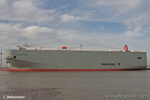
Vessel Chesapeake Highway IMO: 9565546, MMSI: 351733000 Vehicles Carrier
UTC, 2.92441, -12.03144, course: 146, speed: 18.9
UTC, 2.35877, -11.66315, course: 148, speed: 19
2026-02-22 08:15:48 UTC, 1.67893, -11.21686, course: 147, speed: 18.4
Live AIS position:
UTC. 238 nm SW of Greenville),
updated 2026-02-22 08:15:48 UTC.
Find the position of the vessel Chesapeake Highway on the map. The latter are known coordinates and path.
marine traffic ship tracker show on live map
The current position of vessel Chesapeake Highway is 1.67893 lat / -11.21686 lng. Updated: 2026-02-22 08:15:48 UTCCurrently sailing under the flag of Panama
Chesapeake Highway built in 2010 year
Deadweight:
21643 tDetails:
Last coordinates of the vessel:
UTC, 3.17981, -12.20613, course: 147, speed: 19.1UTC, 2.92441, -12.03144, course: 146, speed: 18.9
UTC, 2.35877, -11.66315, course: 148, speed: 19
2026-02-22 08:15:48 UTC, 1.67893, -11.21686, course: 147, speed: 18.4