 vesseltracker.com
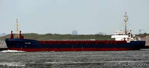
Vessel Christa IMO: 8906250, MMSI: 577285000 Multi Purpose Carrier
UTC, 40.92145, 40.18508, course: 246, speed: 0
UTC, 40.92144, 40.18507, course: 246, speed: 0
2026-01-27 22:38:10 UTC, 40.92145, 40.18509, course: 246, speed: 0
Live AIS position:
UTC. Near Surmene),
updated 2026-01-27 22:38:10 UTC.
Find the position of the vessel Christa on the map. The latter are known coordinates and path.
marine traffic ship tracker show on live map
The current position of vessel Christa is 40.92145 lat / 40.18509 lng. Updated: 2026-01-27 22:38:10 UTCCurrently sailing under the flag of Vanuatu
Christa built in 1989 year
Deadweight:
3015 tDetails:
Last coordinates of the vessel:
UTC, 40.92161, 40.18494, course: 246, speed: 0.2UTC, 40.92145, 40.18508, course: 246, speed: 0
UTC, 40.92144, 40.18507, course: 246, speed: 0
2026-01-27 22:38:10 UTC, 40.92145, 40.18509, course: 246, speed: 0