 vesseltracker.com
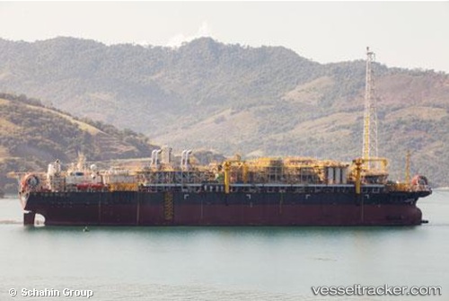
Vessel Cidade D Mangaratiba IMO: 9001007, MMSI: 311076500 Offshore Support Vessel
UTC, -25.20167, -42.87667, course: -1, speed: 0
UTC, -25.20167, -42.87667, course: -1, speed: 0
2026-01-31 14:27:51 UTC, -25.20167, -42.87667, course: -1, speed: 0
Live AIS position:
UTC. 20 nm N of Cidade de Angra dos Reis FPSO),
updated 2026-01-31 14:27:51 UTC.
Find the position of the vessel Cidade D Mangaratiba on the map. The latter are known coordinates and path.
marine traffic ship tracker show on live map
The current position of vessel Cidade D Mangaratiba is -25.20167 lat / -42.87667 lng. Updated: 2026-01-31 14:27:51 UTCDetails:
Last coordinates of the vessel:
UTC, -25.20297, -42.87829, course: 188, speed: 0UTC, -25.20167, -42.87667, course: -1, speed: 0
UTC, -25.20167, -42.87667, course: -1, speed: 0
2026-01-31 14:27:51 UTC, -25.20167, -42.87667, course: -1, speed: 0