 vesseltracker.com
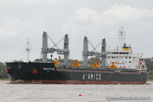
Vessel Cielo Di Jari IMO: 9735452, MMSI: 636017418 Bulk Carrier
UTC, 21.88042, -26.23766, course: 21, speed: 13
UTC, 21.88042, -26.23766, course: 21, speed: 13
2026-01-31 07:52:33 UTC, 21.88042, -26.23766, course: 21, speed: 13
Live AIS position:
UTC. 308 nm N of Porto Grande),
updated 2026-01-31 07:52:33 UTC.
Find the position of the vessel Cielo Di Jari on the map. The latter are known coordinates and path.
marine traffic ship tracker show on live map
The current position of vessel Cielo Di Jari is 21.88042 lat / -26.23766 lng. Updated: 2026-01-31 07:52:33 UTCCurrently sailing under the flag of Liberia
Details:
Last coordinates of the vessel:
UTC, 21.09984, -26.55310, course: 23, speed: 12.1UTC, 21.88042, -26.23766, course: 21, speed: 13
UTC, 21.88042, -26.23766, course: 21, speed: 13
2026-01-31 07:52:33 UTC, 21.88042, -26.23766, course: 21, speed: 13