 vesseltracker.com
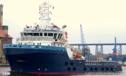
Vessel Cindy Tide IMO: 9421702, MMSI: 345050073 Offshore Tug Supply Ship
UTC, 18.43167, -93.18667, course: -1, speed: 0
UTC, 18.43307, -93.18707, course: 359, speed: 0
2026-01-31 05:26:47 UTC, 18.43307, -93.18708, course: 359, speed: 0
Live AIS position:
UTC. Near DOS BOCAS),
updated 2026-01-31 05:26:47 UTC.
Find the position of the vessel Cindy Tide on the map. The latter are known coordinates and path.
marine traffic ship tracker show on live map
The current position of vessel Cindy Tide is 18.43307 lat / -93.18708 lng. Updated: 2026-01-31 05:26:47 UTCCurrently sailing under the flag of Mexico
Cindy Tide built in 2008 year
Deadweight:
2020 tDetails:
Last coordinates of the vessel:
UTC, 18.43167, -93.18667, course: -1, speed: 0UTC, 18.43167, -93.18667, course: -1, speed: 0
UTC, 18.43307, -93.18707, course: 359, speed: 0
2026-01-31 05:26:47 UTC, 18.43307, -93.18708, course: 359, speed: 0