 vesseltracker.com
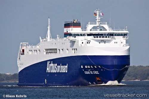
Vessel Ciudad De Cadiz IMO: 9383560, MMSI: 228025700 Ro Ro Cargo Ship
UTC, 32.37515, -62.20998, course: 67, speed: 10.6
UTC, 32.48000, -61.79500, course: -1, speed: 9
2026-01-30 17:45:31 UTC, 32.57333, -61.46500, course: -1, speed: 9
Live AIS position:
UTC. 163 nm E of Saint George),
updated 2026-01-30 17:45:31 UTC.
Find the position of the vessel Ciudad De Cadiz on the map. The latter are known coordinates and path.
marine traffic ship tracker show on live map
The current position of vessel Ciudad De Cadiz is 32.57333 lat / -61.46500 lng. Updated: 2026-01-30 17:45:31 UTCDetails:
Last coordinates of the vessel:
UTC, 32.26667, -62.66333, course: -1, speed: 9UTC, 32.37515, -62.20998, course: 67, speed: 10.6
UTC, 32.48000, -61.79500, course: -1, speed: 9
2026-01-30 17:45:31 UTC, 32.57333, -61.46500, course: -1, speed: 9