 vesseltracker.com
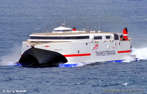
Vessel Ciudad De Ceuta IMO: 9237644, MMSI: 224239000 Passenger Ro Ro Cargo Ship
Live AIS position:
UTC. Near Las Palmas),
updated 2026-01-05 05:45:45 UTC.
Find the position of the vessel Ciudad De Ceuta on the map. The latter are known coordinates and path.
marine traffic ship tracker show on live map
The current position of vessel Ciudad De Ceuta is 28.14617 lat / -15.42134 lng. Updated: 2026-01-05 05:45:45 UTCCurrently sailing under the flag of Spain
Ciudad De Ceuta built in 2003 year
Deadweight:
758 tDetails:
Last coordinates of the vessel:
2026-01-05 05:45:45 UTC, 28.14617, -15.42134, course: 182, speed: 0