 vesseltracker.com
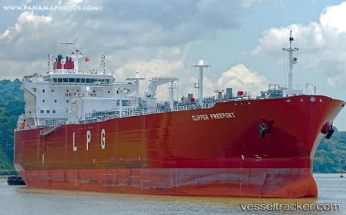
Vessel Clipper Freeport IMO: 9789154, MMSI: 259104000 Lpg Tanker
UTC, -15.60868, 61.19661, course: 33, speed: 15.3
UTC, -15.14382, 61.46476, course: 29, speed: 15.3
2026-01-29 07:55:24 UTC, -14.75500, 61.68333, course: -1, speed: 15
Live AIS position:
UTC. 312 nm N of Port Mathurin),
updated 2026-01-29 07:55:24 UTC.
Find the position of the vessel Clipper Freeport on the map. The latter are known coordinates and path.
marine traffic ship tracker show on live map
The current position of vessel Clipper Freeport is -14.75500 lat / 61.68333 lng. Updated: 2026-01-29 07:55:24 UTCCurrently sailing under the flag of Norway
Details:
Last coordinates of the vessel:
UTC, -16.12295, 60.88582, course: 30, speed: 14.7UTC, -15.60868, 61.19661, course: 33, speed: 15.3
UTC, -15.14382, 61.46476, course: 29, speed: 15.3
2026-01-29 07:55:24 UTC, -14.75500, 61.68333, course: -1, speed: 15