 vesseltracker.com
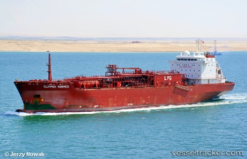
Vessel Clipper Hermod IMO: 9378163, MMSI: 258669000 Lpg Tanker
UTC, 8.93083, -79.55396, course: 321, speed: 4.4
UTC, 9.01667, -79.61196, course: 312, speed: 0
2026-01-30 01:23:15 UTC, 9.11477, -79.70440, course: 280, speed: 3.1
Live AIS position:
UTC. Near Panama Canal),
updated 2026-01-30 01:23:15 UTC.
Find the position of the vessel Clipper Hermod on the map. The latter are known coordinates and path.
marine traffic ship tracker show on live map
The current position of vessel Clipper Hermod is 9.11477 lat / -79.70440 lng. Updated: 2026-01-30 01:23:15 UTCDetails:
Last coordinates of the vessel:
UTC, 8.87209, -79.52502, course: 0, speed: 0UTC, 8.93083, -79.55396, course: 321, speed: 4.4
UTC, 9.01667, -79.61196, course: 312, speed: 0
2026-01-30 01:23:15 UTC, 9.11477, -79.70440, course: 280, speed: 3.1