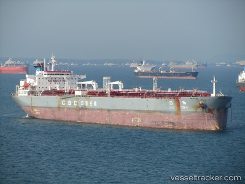
vessel Clivia IMO: 9350654, Crude Oil Tanker vesseltracker.com
Vessel Clivia IMO: 9350654, Crude Oil Tanker
MMSI: 538009585 callsign: V7A4921 size: 244x42

Find the position of the vessel Clivia on the map. The latter are known coordinates and path.

marine traffic ship tracker show on live map

The current position of vessel Clivia is 14.150101661682129 lat / 122.14270782470703 lng. Updated: 2023-06-09 03:57:28 UTC

Currently sailing under the flag of Marshall Islands

Details:


Last coordinates of the vessel:
2023-06-09 03:57:28 UTC, 14.150101661682129, 122.14270782470703, course: 47, speed: 0.3

Track of the vessel in the last 14 days


Most frequent ports a vessels calls at Clivia (538009585):

Sambu, traffic: 12
Dagu Bar, traffic: 9
Taku Bar, traffic: 8
Singapore, traffic: 6
Malacca, traffic: 5
Wei Hai Wei, traffic: 4
Weihai, traffic: 4
Dagu, traffic: 3
Ta-Ku, traffic: 3
Nakhodka, traffic: 2
Port Kelang, traffic: 1
Port Swettenham, traffic: 1

Link to the map:


Find another ship

Clivia (538009585) last ports (portcalls and passsages)

Nakhodka | 2022-12-18 20:58:27
Malacca | 2022-11-12 05:47:44
Port Swettenham | 2022-11-01 14:46:02
Singapore | 2022-10-26 22:48:49
Nakhodka | 2022-10-03 01:30:53
Wei Hai Wei | 2022-06-10 07:46:27
Weihai | 2022-06-06 07:45:26
Weihai | 2022-06-02 07:36:27
Wei Hai Wei | 2022-05-29 07:32:23
Dagu Bar | 2022-05-20 08:01:57
Ta-Ku | 2022-05-17 07:59:06
Singapore | 2022-02-22 16:00:29
Malacca | 2022-02-19 23:57:55
Sambu | 2022-01-17 21:40:38
Singapore | 2022-01-17 20:50:57
Sambu | 2022-01-17 20:45:47
Malacca | 2022-01-15 05:31:03
Sambu | 2022-01-11 23:55:56
Sambu | 2022-01-11 23:40:46
Taku Bar | 2021-12-22 10:41:32
Dagu Bar | 2021-12-22 10:23:23
Dagu Bar | 2021-12-22 09:36:22
Ta-Ku | 2021-12-19 21:45:50
Dagu Bar | 2021-12-19 20:43:01
Taku Bar | 2021-12-19 19:56:40
Taku Bar | 2021-12-19 19:13:38