 vesseltracker.com
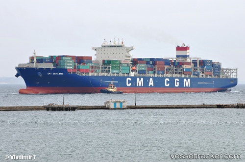
Vessel Cma Cgm Loire IMO: 9674531, MMSI: 229947000 Container Ship
UTC, 54.11667, 6.02333, course: -1, speed: 12
UTC, 54.14803, 6.86278, course: 89, speed: 14.1
2026-02-24 01:25:56 UTC, 54.15255, 7.37917, course: 89, speed: 14.1
Live AIS position:
UTC. 12 nm S of Haspe),
updated 2026-02-24 01:25:56 UTC.
Find the position of the vessel Cma Cgm Loire on the map. The latter are known coordinates and path.
marine traffic ship tracker show on live map
The current position of vessel Cma Cgm Loire is 54.15255 lat / 7.37917 lng. Updated: 2026-02-24 01:25:56 UTCCurrently sailing under the flag of Malta
Details:
Last coordinates of the vessel:
UTC, 54.07522, 5.48680, course: 81, speed: 12.1UTC, 54.11667, 6.02333, course: -1, speed: 12
UTC, 54.14803, 6.86278, course: 89, speed: 14.1
2026-02-24 01:25:56 UTC, 54.15255, 7.37917, course: 89, speed: 14.1