 vesseltracker.com
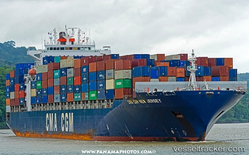
Vessel Cma Cgm New Jersey IMO: 9351141, MMSI: 215183000 Container Ship
UTC, 26.1001, 121.206, course: 222, speed: 19.4
UTC, 25.7648, 120.839, course: 222, speed: 11.2
2026-02-24 03:23:46 UTC, 25.6375, 120.682, course: 227, speed: 11.2
Live AIS position:
UTC. 43 nm NW of Sha-lun),
updated 2026-02-24 03:23:46 UTC.
Find the position of the vessel Cma Cgm New Jersey on the map. The latter are known coordinates and path.
marine traffic ship tracker show on live map
The current position of vessel Cma Cgm New Jersey is 25.6375 lat / 120.682 lng. Updated: 2026-02-24 03:23:46 UTCDetails:
Last coordinates of the vessel:
UTC, 26.4346, 121.54, course: 225, speed: 10.1UTC, 26.1001, 121.206, course: 222, speed: 19.4
UTC, 25.7648, 120.839, course: 222, speed: 11.2
2026-02-24 03:23:46 UTC, 25.6375, 120.682, course: 227, speed: 11.2