vessel Columbus IMO: 8611398, Cruise Ship
vesseltracker.com
Vessel Columbus IMO: 8611398, Cruise Ship
MMSI: 311000535 callsign: C6CP4 size: 245x35

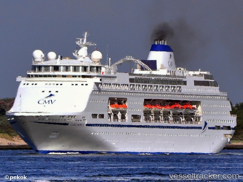
Find the position of the vessel Columbus on the map. The latter are known coordinates and path.

marine traffic ship tracker show on live map

The current position of vessel Columbus is 88.2987 lat / -63.0337 lng. Updated: 2025-06-13 11:47:58 UTC

Currently sailing under the flag of Bahamas

Columbus built in 1989 year

Deadweight:
7505 t

Details:


Last coordinates of the vessel:
2025-06-13 11:47:58 UTC, 88.2987, -63.0337, course: -1, speed: 9.5

Track of the vessel in the last 14 days


Most frequent ports a vessels calls at Columbus (311000535):

Cotonou, traffic: 3
Apapa, traffic: 2
HOEK VAN HOLLAND, traffic: 1
BRIELLE, traffic: 1
Kpeme, traffic: 1
Lome, traffic: 1
Maassluis, traffic: 1
Vlaardingen, traffic: 1
BOTLEK - ROTTERDAM, traffic: 1

Link to the map:


Find another ship

Columbus (311000535) last ports (portcalls and passsages)

BRIELLE | 2025-05-24 02:20:32
Lome | 2022-12-29 11:53:24
Kpeme | 2022-12-29 09:10:38
Cotonou | 2022-12-29 02:32:55
Cotonou | 2022-11-12 11:36:27
Cotonou | 2022-10-08 10:36:15
Apapa | 2022-10-07 19:38:54
Apapa | 2022-08-26 04:06:14