 vesseltracker.com
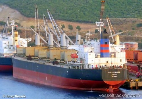
Vessel Coral Island IMO: 9304112, MMSI: 249397000 Bulk Carrier
UTC, 54.06645, 7.42653, course: 233, speed: 0
UTC, 54.06763, 7.42210, course: 158, speed: 0.1
2026-02-09 16:12:45 UTC, 54.06678, 7.42065, course: 113, speed: 0
Live AIS position:
UTC. 17 nm S of Haspe),
updated 2026-02-09 16:12:45 UTC.
Find the position of the vessel Coral Island on the map. The latter are known coordinates and path.
marine traffic ship tracker show on live map
The current position of vessel Coral Island is 54.06678 lat / 7.42065 lng. Updated: 2026-02-09 16:12:45 UTCCurrently sailing under the flag of Malta
Coral Island built in 2006 year
Deadweight:
55699 tDetails:
Last coordinates of the vessel:
UTC, 54.06790, 7.42360, course: 191, speed: 0.1UTC, 54.06645, 7.42653, course: 233, speed: 0
UTC, 54.06763, 7.42210, course: 158, speed: 0.1
2026-02-09 16:12:45 UTC, 54.06678, 7.42065, course: 113, speed: 0