 vesseltracker.com
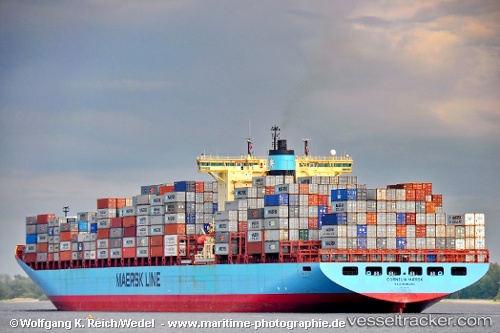
Vessel Cornelia Maersk IMO: 9245756, MMSI: 220061000 Container Ship
UTC, 29.83323, 32.56972, course: 207, speed: 0
UTC, 30.10352, 32.57052, course: 359, speed: 8.7
2026-02-08 12:25:20 UTC, 30.32279, 32.40515, course: 322, speed: 8.8
Live AIS position:
UTC. Near SUEZ CANAL),
updated 2026-02-08 12:25:20 UTC.
Find the position of the vessel Cornelia Maersk on the map. The latter are known coordinates and path.
marine traffic ship tracker show on live map
The current position of vessel Cornelia Maersk is 30.32279 lat / 32.40515 lng. Updated: 2026-02-08 12:25:20 UTCCurrently sailing under the flag of Denmark
Cornelia Maersk built in 2002 year
Deadweight:
104600 tDetails:
Last coordinates of the vessel:
UTC, 29.83344, 32.56790, course: 167, speed: 0UTC, 29.83323, 32.56972, course: 207, speed: 0
UTC, 30.10352, 32.57052, course: 359, speed: 8.7
2026-02-08 12:25:20 UTC, 30.32279, 32.40515, course: 322, speed: 8.8