 vesseltracker.com
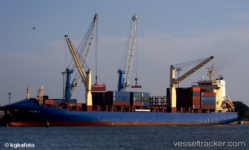
Vessel Corona J IMO: 9238686, MMSI: 304813000 Container Ship
UTC, 34.64650, -76.63611, course: 335, speed: 0.4
UTC, 34.64681, -76.63586, course: 305, speed: 0.5
2026-02-07 18:15:41 UTC, 34.64700, -76.63539, course: 309, speed: 0.7
Live AIS position:
UTC. Near Morehead City),
updated 2026-02-07 18:15:41 UTC.
Find the position of the vessel Corona J on the map. The latter are known coordinates and path.
marine traffic ship tracker show on live map
The current position of vessel Corona J is 34.64700 lat / -76.63539 lng. Updated: 2026-02-07 18:15:41 UTCCurrently sailing under the flag of Antigua Barbuda
Corona J built in 2002 year
Deadweight:
16794 tDetails:
Last coordinates of the vessel:
UTC, 34.64752, -76.63523, course: 299, speed: 0.5UTC, 34.64650, -76.63611, course: 335, speed: 0.4
UTC, 34.64681, -76.63586, course: 305, speed: 0.5
2026-02-07 18:15:41 UTC, 34.64700, -76.63539, course: 309, speed: 0.7