 vesseltracker.com
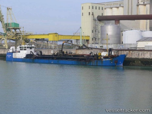
Vessel Cotes De Bretagne IMO: 9171682, MMSI: 227003850 Hopper Dredger
UTC, 48.72340, -3.87662, course: 46, speed: 1.6
UTC, 48.74661, -3.81132, course: 64, speed: 9.6
2026-02-23 23:11:43 UTC, 48.84003, -3.63364, course: 60, speed: 9.1
Live AIS position:
UTC. Near Trébeurden),
updated 2026-02-23 23:11:43 UTC.
Find the position of the vessel Cotes De Bretagne on the map. The latter are known coordinates and path.
marine traffic ship tracker show on live map
The current position of vessel Cotes De Bretagne is 48.84003 lat / -3.63364 lng. Updated: 2026-02-23 23:11:43 UTCCurrently sailing under the flag of France
Cotes De Bretagne built in 1998 year
Deadweight:
2400 tDetails:
Last coordinates of the vessel:
UTC, 48.72957, -4.33269, course: 72, speed: 12.8UTC, 48.72340, -3.87662, course: 46, speed: 1.6
UTC, 48.74661, -3.81132, course: 64, speed: 9.6
2026-02-23 23:11:43 UTC, 48.84003, -3.63364, course: 60, speed: 9.1