 vesseltracker.com
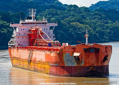
Vessel Csl Tarantau IMO: 9600982, MMSI: 311000508 Self Discharging Bulk Carrier
UTC, 27.91180, -82.44105, course: 333, speed: 0
UTC, 27.91177, -82.44102, course: 333, speed: 0
2026-02-01 19:40:22 UTC, 27.71633, -82.54066, course: 211, speed: 11.6
Live AIS position:
UTC. Near Port Manatee),
updated 2026-02-01 19:40:22 UTC.
Find the position of the vessel Csl Tarantau on the map. The latter are known coordinates and path.
marine traffic ship tracker show on live map
The current position of vessel Csl Tarantau is 27.71633 lat / -82.54066 lng. Updated: 2026-02-01 19:40:22 UTCCurrently sailing under the flag of Bahamas
Csl Tarantau built in 2013 year
Deadweight:
71500 tDetails:
Last coordinates of the vessel:
UTC, 27.91179, -82.44104, course: 333, speed: 0UTC, 27.91180, -82.44105, course: 333, speed: 0
UTC, 27.91177, -82.44102, course: 333, speed: 0
2026-02-01 19:40:22 UTC, 27.71633, -82.54066, course: 211, speed: 11.6