 vesseltracker.com
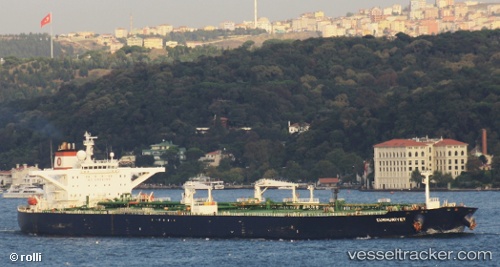
Vessel Cumhuriyet IMO: 9225081, MMSI: 271000637 Crude Oil Tanker
Live AIS position:
UTC. 11 nm N of INEBOLU),
updated 2025-05-18 00:30:58 UTC.
Find the position of the vessel Cumhuriyet on the map. The latter are known coordinates and path.
marine traffic ship tracker show on live map
The current position of vessel Cumhuriyet is 42.15812 lat / 33.76890 lng. Updated: 2025-05-18 00:30:58 UTCCurrently sailing under the flag of Turkey
Cumhuriyet built in 2001 year
Deadweight:
164859 tDetails:
Last coordinates of the vessel:
2025-05-18 00:30:58 UTC, 42.15812, 33.76890, course: 264, speed: 8.2