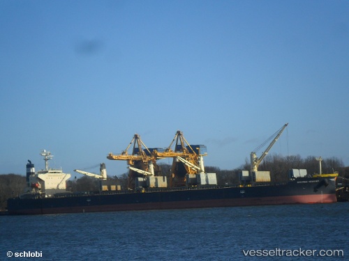
vessel Daidan Pertiwi IMO: 9302798, Bulk Carrier
vesseltracker.com
Vessel Daidan Pertiwi IMO: 9302798, Bulk Carrier
MMSI: 525300129 callsign: YCPI2 size: 32x189

Find the position of the vessel Daidan Pertiwi on the map. The latter are known coordinates and path.

marine traffic ship tracker show on live map

The current position of vessel Daidan Pertiwi is -5.66258 lat / 111.152 lng. Updated: 2024-04-20 01:26:30 UTC
Port of registry:
Jakarta (capital city and smallest province of Indonesia)
Payload_mass:
55820 tonne
Gross tonnage:
30822
Service entry:
2005-01-01T00:00:00Z
Details:


Last coordinates of the vessel:
UTC, -5.66498, 110.408, course: 89, speed: 11.2
UTC, -5.66403, 110.7, course: 89, speed: 11
UTC, -5.66287, 110.939, course: 89, speed: 11.5
2024-04-20 01:26:30 UTC, -5.66258, 111.152, course: 89, speed: 11.5

Track of the vessel in the last 14 days


Most frequent ports a vessels calls at Daidan Pertiwi (525300129):

Sambu, traffic: 5
Tandjung Uban, traffic: 4
Muara Pantai, traffic: 4
Selat Sunda, traffic: 3

Link to the map:


Find another ship

Daidan_Pertiwi (525300129) last ports (portcalls and passsages)

Muara Pantai | 2024-04-01 01:15:25
Muara Pantai | 2024-03-27 22:35:11
Selat Sunda | 2023-10-30 16:46:52
Tandjung Uban | 2023-10-23 07:04:55
Tandjung Uban | 2023-10-19 06:10:51
Tandjung Uban | 2023-10-15 04:49:57
Tandjung Uban | 2023-10-11 04:45:34
Selat Sunda | 2023-09-30 07:50:56
Selat Sunda | 2023-09-23 08:26:39
Muara Pantai | 2023-09-04 10:05:19
Muara Pantai | 2023-08-31 09:18:02
Sambu | 2023-02-23 17:16:25
Sambu | 2023-02-19 17:02:40
Sambu | 2023-02-15 09:01:07
Sambu | 2023-02-11 08:41:35
Sambu | 2023-02-07 05:52:01