 vesseltracker.com
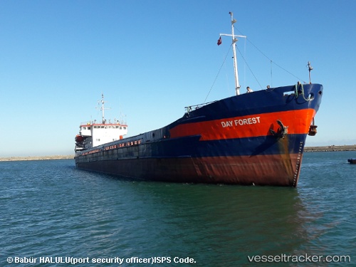
Vessel DAY FOREST IMO: 8857992, MMSI: 577507000 General Cargo Ship
UTC, 46.98375, 38.41063, course: -1, speed: 0.4
UTC, 46.98375, 38.41063, course: -1, speed: 0.4
2026-03-22 10:45:18 UTC, 46.98375, 38.41063, course: -1, speed: 0.4
Live Vessel DAY FOREST Analytics (details, animations, etc.)
Live AIS position: UTC. 26 nm SW of Taganrog), updated 2026-03-22 10:45:18 UTC.Find the position of the vessel DAY FOREST on the map. The latter are known coordinates and path.
marine traffic ship tracker show on live map
The current position of vessel DAY FOREST is 46.98375 lat / 38.41063 lng. Updated: 2026-03-22 10:45:18 UTCCurrently sailing under the flag of Vanuatu
DAY FOREST built in 1982 year
Deadweight:
3197 tDetails:
Last coordinates of the vessel:
UTC, 46.98375, 38.41077, course: -1, speed: 0UTC, 46.98375, 38.41063, course: -1, speed: 0.4
UTC, 46.98375, 38.41063, course: -1, speed: 0.4
2026-03-22 10:45:18 UTC, 46.98375, 38.41063, course: -1, speed: 0.4