vessel Deep Blue IMO: 9215359, Pipe Layer
Vessel Deep Blue IMO: 9215359, Pipe Layer
MMSI: 311105000 callsign: C6RM8 size: 206x32

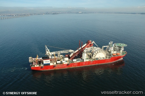
Find the position of the vessel Deep Blue on the map. The latter are known coordinates and path.

marine traffic ship tracker show on live map

The current position of vessel Deep Blue is 10.6134 lat / -61.6438 lng. Updated: 2024-04-19 12:02:27 UTC

Currently sailing under the flag of Bahamas

Deep Blue built in 2001 year

Port of registry:
Nassau (capital city of the Commonwealth of the Bahamas)
Speed:
10 knot
Deadweight:
25449 t

Payload_mass:
25449 tonne
Gross tonnage:
33791
Beam:
33 metre
Operator:
TechnipFMC (U.K.-domiciled energy company)
Service entry:
2001-01-01T00:00:00Z

Manufacturer:
Hyundai Mipo Dockyard (South Korean shipbuilding company)

Owned:
TechnipFMC (U.K.-domiciled energy company)
Details:


Last coordinates of the vessel:
UTC, 10.6134, -61.6447, course: 89, speed: 0
UTC, 10.6136, -61.6443, course: 173, speed: 0
UTC, 10.6133, -61.6433, course: -1, speed: 0
2024-04-19 12:02:27 UTC, 10.6134, -61.6438, course: 282, speed: 0

Track of the vessel in the last 14 days


Most frequent ports a vessels calls at Deep Blue (311105000):

Rio De Janeiro, traffic: 9
Cape Lopez, traffic: 4
Las Palmas, traffic: 2
Luanda, traffic: 2
Port Gentil, traffic: 2
Puerto De La Luz, traffic: 2

Link to the map:


Find another ship

Deep_Blue (311105000) last ports (portcalls and passsages)

Rio De Janeiro | 2023-07-16 14:12:13
Rio De Janeiro | 2023-07-12 13:55:23
Rio De Janeiro | 2023-07-08 12:10:43
Rio De Janeiro | 2023-07-04 11:27:58
Rio De Janeiro | 2023-06-30 10:02:09
Rio De Janeiro | 2023-06-26 09:54:19
Rio De Janeiro | 2023-04-18 16:55:14
Rio De Janeiro | 2022-08-07 13:42:54
Rio De Janeiro | 2022-02-19 21:15:00
Las Palmas | 2022-01-03 18:05:16
Cape Lopez | 2021-12-22 19:20:40
Port Gentil | 2021-12-16 07:53:38
Luanda | 2021-12-07 11:39:55