 vesseltracker.com
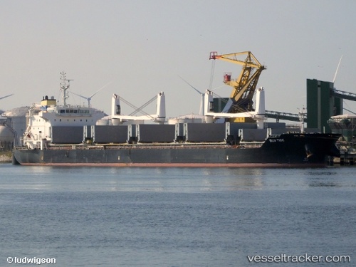
Vessel ECO TIDE IMO: 9576739, MMSI: 255806435 Bulk Carrier
UTC, 41.24898, 36.44459, course: 359, speed: 0
UTC, 41.24899, 36.44456, course: 359, speed: 0
2026-02-14 06:26:58 UTC, 41.24914, 36.44451, course: 359, speed: 0
Live AIS position:
UTC. Near Samsun),
updated 2026-02-14 06:26:58 UTC.
Find the position of the vessel ECO TIDE on the map. The latter are known coordinates and path.
marine traffic ship tracker show on live map
The current position of vessel ECO TIDE is 41.24914 lat / 36.44451 lng. Updated: 2026-02-14 06:26:58 UTCCurrently sailing under the flag of Portugal
ECO TIDE built in 2011 year
Deadweight:
35916 tDetails:
Last coordinates of the vessel:
UTC, 41.24901, 36.44459, course: 359, speed: 0UTC, 41.24898, 36.44459, course: 359, speed: 0
UTC, 41.24899, 36.44456, course: 359, speed: 0
2026-02-14 06:26:58 UTC, 41.24914, 36.44451, course: 359, speed: 0