 vesseltracker.com
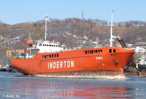
Vessel ELDUGA IMO: 8907254, MMSI: 671806000 Ro-Ro Cargo
UTC, 34.08695, 129.05151, course: 272, speed: 0.5
UTC, 34.08695, 129.05151, course: 272, speed: 0.5
2026-03-14 06:02:50 UTC, 34.05841, 129.02838, course: 266, speed: 0.7
Live Vessel ELDUGA Analytics (details, animations, etc.)
Live AIS position: UTC. 15 nm SW of IZUHARA), updated 2026-03-14 06:02:50 UTC.Find the position of the vessel ELDUGA on the map. The latter are known coordinates and path.
marine traffic ship tracker show on live map
The current position of vessel ELDUGA is 34.05841 lat / 129.02838 lng. Updated: 2026-03-14 06:02:50 UTCCurrently sailing under the flag of Togo
ELDUGA built in 1989 year
Deadweight:
2553 tDetails:
Last coordinates of the vessel:
UTC, 34.09536, 129.05263, course: 293, speed: 0.8UTC, 34.08695, 129.05151, course: 272, speed: 0.5
UTC, 34.08695, 129.05151, course: 272, speed: 0.5
2026-03-14 06:02:50 UTC, 34.05841, 129.02838, course: 266, speed: 0.7