 vesseltracker.com
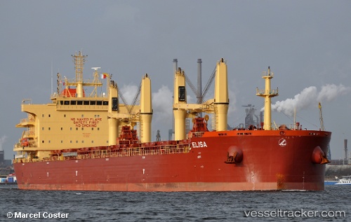
Vessel ELISA IMO: 9730232, MMSI: 538008573
UTC, 31.29607, 123.05376, course: 12, speed: 1.2
UTC, 31.29466, 123.05612, course: 314, speed: 0.7
2026-02-07 22:21:34 UTC, 31.28457, 123.05927, course: 347, speed: 0.6
Live AIS position:
UTC. 35 nm E of Jingjiang),
updated 2026-02-07 22:21:34 UTC.
Find the position of the vessel ELISA on the map. The latter are known coordinates and path.
marine traffic ship tracker show on live map
The current position of vessel ELISA is 31.28457 lat / 123.05927 lng. Updated: 2026-02-07 22:21:34 UTCDetails:
Last coordinates of the vessel:
UTC, 31.29337, 123.00310, course: 83, speed: 8UTC, 31.29607, 123.05376, course: 12, speed: 1.2
UTC, 31.29466, 123.05612, course: 314, speed: 0.7
2026-02-07 22:21:34 UTC, 31.28457, 123.05927, course: 347, speed: 0.6