 vesseltracker.com
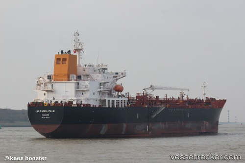
Vessel Elandra Palm IMO: 9746267, MMSI: 538006776 Chemical Oil Products Tanker
UTC, 27.41972, -94.21216, course: 147, speed: 12.2
UTC, 27.14331, -94.00836, course: 144, speed: 12.1
2026-02-10 11:54:14 UTC, 26.81661, -93.74106, course: 144, speed: 12.4
Live AIS position:
UTC. 151 nm SE of Quintana),
updated 2026-02-10 11:54:14 UTC.
Find the position of the vessel Elandra Palm on the map. The latter are known coordinates and path.
marine traffic ship tracker show on live map
The current position of vessel Elandra Palm is 26.81661 lat / -93.74106 lng. Updated: 2026-02-10 11:54:14 UTCCurrently sailing under the flag of Marshall Is
Details:
Last coordinates of the vessel:
UTC, 27.82715, -94.42327, course: 182, speed: 11.8UTC, 27.41972, -94.21216, course: 147, speed: 12.2
UTC, 27.14331, -94.00836, course: 144, speed: 12.1
2026-02-10 11:54:14 UTC, 26.81661, -93.74106, course: 144, speed: 12.4