 vesseltracker.com
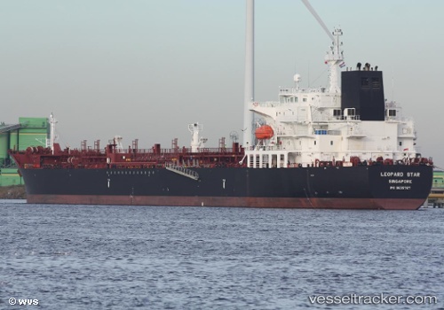
Vessel Elandra Star IMO: 9635767, MMSI: 538008361 Chemical Oil Products Tanker
UTC, -25.68437, -48.11196, course: 96, speed: 0.1
UTC, -25.64211, -48.23998, course: 304, speed: 2.9
2026-02-10 07:24:52 UTC, -25.49788, -48.41678, course: 300, speed: 10.7
Live AIS position:
UTC. Near Paranagua),
updated 2026-02-10 07:24:52 UTC.
Find the position of the vessel Elandra Star on the map. The latter are known coordinates and path.
marine traffic ship tracker show on live map
The current position of vessel Elandra Star is -25.49788 lat / -48.41678 lng. Updated: 2026-02-10 07:24:52 UTCDetails:
Last coordinates of the vessel:
UTC, -25.68445, -48.11197, course: 93, speed: 0.1UTC, -25.68437, -48.11196, course: 96, speed: 0.1
UTC, -25.64211, -48.23998, course: 304, speed: 2.9
2026-02-10 07:24:52 UTC, -25.49788, -48.41678, course: 300, speed: 10.7