 vesseltracker.com
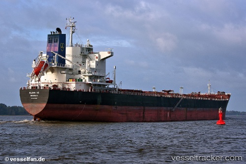
Vessel Elena Ve IMO: 9453066, MMSI: 636014709 Bulk Carrier
UTC, 51.53155, -142.81903, course: 286, speed: 8.6
UTC, 51.66919, -143.46289, course: 291, speed: 9.3
2026-02-09 06:03:47 UTC, 51.76741, -143.86623, course: 291, speed: 9.9
Live AIS position:
UTC. 197 nm E of Kings Bromley),
updated 2026-02-09 06:03:47 UTC.
Find the position of the vessel Elena Ve on the map. The latter are known coordinates and path.
marine traffic ship tracker show on live map
The current position of vessel Elena Ve is 51.76741 lat / -143.86623 lng. Updated: 2026-02-09 06:03:47 UTCCurrently sailing under the flag of Liberia
Elena Ve built in 2010 year
Deadweight:
75750 tDetails:
Last coordinates of the vessel:
UTC, 51.42547, -142.35577, course: 286, speed: 8.8UTC, 51.53155, -142.81903, course: 286, speed: 8.6
UTC, 51.66919, -143.46289, course: 291, speed: 9.3
2026-02-09 06:03:47 UTC, 51.76741, -143.86623, course: 291, speed: 9.9