 vesseltracker.com
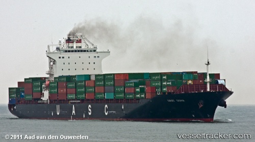
Vessel Eleni T IMO: 9397585, MMSI: 538007684 Container Ship
UTC, 20.54415, 59.24112, course: 25, speed: 12
UTC, 20.76037, 59.34037, course: 18, speed: 12.6
2026-02-08 22:09:27 UTC, 21.28401, 59.58037, course: 18, speed: 12.4
Live AIS position:
UTC. 55 nm NE of MASIRAH),
updated 2026-02-08 22:09:27 UTC.
Find the position of the vessel Eleni T on the map. The latter are known coordinates and path.
marine traffic ship tracker show on live map
The current position of vessel Eleni T is 21.28401 lat / 59.58037 lng. Updated: 2026-02-08 22:09:27 UTCCurrently sailing under the flag of Marshall Is
Eleni T built in 2009 year
Deadweight:
50700 tDetails:
Last coordinates of the vessel:
UTC, 20.12346, 58.98940, course: 32, speed: 11.7UTC, 20.54415, 59.24112, course: 25, speed: 12
UTC, 20.76037, 59.34037, course: 18, speed: 12.6
2026-02-08 22:09:27 UTC, 21.28401, 59.58037, course: 18, speed: 12.4