 vesseltracker.com
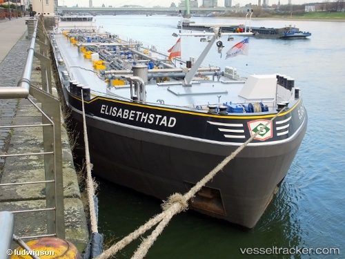
Vessel Elisabethstad IMO: 9537692, MMSI: 205491290 Chemical Oil Products Tanker
UTC, 52.41914, 4.80950, course: -1, speed: 0
UTC, 52.41910, 4.80949, course: -1, speed: 0
2026-02-07 16:08:02 UTC, 52.41911, 4.80950, course: -1, speed: 0
Live AIS position:
UTC. Near ZAANDAM),
updated 2026-02-07 16:08:02 UTC.
Find the position of the vessel Elisabethstad on the map. The latter are known coordinates and path.
marine traffic ship tracker show on live map
The current position of vessel Elisabethstad is 52.41911 lat / 4.80950 lng. Updated: 2026-02-07 16:08:02 UTCCurrently sailing under the flag of Belgium
Details:
Last coordinates of the vessel:
UTC, 52.41914, 4.80950, course: -1, speed: 0UTC, 52.41914, 4.80950, course: -1, speed: 0
UTC, 52.41910, 4.80949, course: -1, speed: 0
2026-02-07 16:08:02 UTC, 52.41911, 4.80950, course: -1, speed: 0