 vesseltracker.com
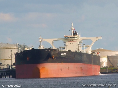
Vessel Eliza IMO: 9387578, MMSI: 636013372 Crude Oil Tanker
UTC, 25.34952, 56.52867, course: 263, speed: 0
UTC, 25.34855, 56.52863, course: 287, speed: 0
2026-02-08 03:54:38 UTC, 25.34620, 56.52277, course: 47, speed: 0.1
Live AIS position:
UTC. Near KHORFAKKAN),
updated 2026-02-08 03:54:38 UTC.
Find the position of the vessel Eliza on the map. The latter are known coordinates and path.
marine traffic ship tracker show on live map
The current position of vessel Eliza is 25.34620 lat / 56.52277 lng. Updated: 2026-02-08 03:54:38 UTCCurrently sailing under the flag of Liberia
Eliza built in 2008 year
Deadweight:
318000 tDetails:
Last coordinates of the vessel:
UTC, 25.35038, 56.52855, course: 249, speed: 0.1UTC, 25.34952, 56.52867, course: 263, speed: 0
UTC, 25.34855, 56.52863, course: 287, speed: 0
2026-02-08 03:54:38 UTC, 25.34620, 56.52277, course: 47, speed: 0.1