 vesseltracker.com
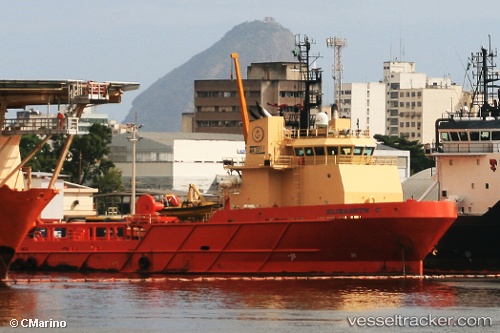
Vessel Elizabeth C IMO: 9423229, MMSI: 710000115 Offshore Tug Supply Ship
UTC, -22.88937, -43.15378, course: 346, speed: 7
UTC, -22.87245, -43.12603, course: 37, speed: 0
2026-02-07 21:34:08 UTC, -22.87195, -43.12593, course: 37, speed: 0
Live AIS position:
UTC. Near NITEROI),
updated 2026-02-07 21:34:08 UTC.
Find the position of the vessel Elizabeth C on the map. The latter are known coordinates and path.
marine traffic ship tracker show on live map
The current position of vessel Elizabeth C is -22.87195 lat / -43.12593 lng. Updated: 2026-02-07 21:34:08 UTCDetails:
Last coordinates of the vessel:
UTC, -23.05492, -42.91895, course: 271, speed: 9.6UTC, -22.88937, -43.15378, course: 346, speed: 7
UTC, -22.87245, -43.12603, course: 37, speed: 0
2026-02-07 21:34:08 UTC, -22.87195, -43.12593, course: 37, speed: 0