 vesseltracker.com
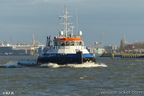
Vessel Ella F IMO: 9813498, MMSI: 244020028 Tug
UTC, -34.40474, 26.06454, course: 82, speed: 9
UTC, -34.36243, 26.31970, course: 83, speed: 7.8
2026-02-08 07:35:52 UTC, -34.32339, 26.57493, course: 74, speed: 5
Live AIS position:
UTC. 40 nm S of Kenton-on-Sea),
updated 2026-02-08 07:35:52 UTC.
Find the position of the vessel Ella F on the map. The latter are known coordinates and path.
marine traffic ship tracker show on live map
The current position of vessel Ella F is -34.32339 lat / 26.57493 lng. Updated: 2026-02-08 07:35:52 UTCCurrently sailing under the flag of Netherlands
Details:
Last coordinates of the vessel:
UTC, -34.48033, 25.58411, course: 85, speed: 8.3UTC, -34.40474, 26.06454, course: 82, speed: 9
UTC, -34.36243, 26.31970, course: 83, speed: 7.8
2026-02-08 07:35:52 UTC, -34.32339, 26.57493, course: 74, speed: 5