 vesseltracker.com
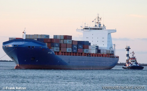
Vessel Em Kea IMO: 9334351, MMSI: 636015646 Container Ship
UTC, 51.41230, 2.60792, course: 160, speed: 0.2
UTC, 51.41008, 2.60600, course: 85, speed: 0
2026-02-08 23:39:38 UTC, 51.40912, 2.60672, course: 66, speed: 0
Live AIS position:
UTC. 16 nm NW of Middelkerke),
updated 2026-02-08 23:39:38 UTC.
Find the position of the vessel Em Kea on the map. The latter are known coordinates and path.
marine traffic ship tracker show on live map
The current position of vessel Em Kea is 51.40912 lat / 2.60672 lng. Updated: 2026-02-08 23:39:38 UTCCurrently sailing under the flag of Liberia
Em Kea built in 2007 year
Deadweight:
42166 tDetails:
Last coordinates of the vessel:
UTC, 51.41205, 2.61124, course: 211, speed: 0UTC, 51.41230, 2.60792, course: 160, speed: 0.2
UTC, 51.41008, 2.60600, course: 85, speed: 0
2026-02-08 23:39:38 UTC, 51.40912, 2.60672, course: 66, speed: 0