 vesseltracker.com
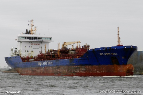
Vessel Emanuele S IMO: 9298363, MMSI: 314446000 Chemical Oil Products Tanker
Live AIS position:
UTC. Near Carenage),
updated 2024-06-20 18:23:21 UTC.
Find the position of the vessel Emanuele S on the map. The latter are known coordinates and path.
marine traffic ship tracker show on live map
The current position of vessel Emanuele S is 10.63138 lat / -61.61212 lng. Updated: 2024-06-20 18:23:21 UTCCurrently sailing under the flag of Barbados
Emanuele S built in 2007 year
Deadweight:
20718 tDetails:
Last coordinates of the vessel:
2024-06-20 18:23:21 UTC, 10.63138, -61.61212, course: 295, speed: 0