 vesseltracker.com
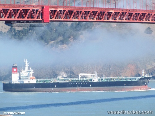
Vessel Empire State IMO: 9408126, MMSI: 367353080 Chemical Oil Products Tanker
UTC, 46.50591, -126.03234, course: 2, speed: 14.4
UTC, 47.15659, -126.02626, course: 0, speed: 14.4
2026-02-01 02:07:40 UTC, 47.42951, -125.87444, course: 33, speed: 12.1
Live AIS position:
UTC. 73 nm SW of Tatoosh Island),
updated 2026-02-01 02:07:40 UTC.
Find the position of the vessel Empire State on the map. The latter are known coordinates and path.
marine traffic ship tracker show on live map
The current position of vessel Empire State is 47.42951 lat / -125.87444 lng. Updated: 2026-02-01 02:07:40 UTCCurrently sailing under the flag of USA
Details:
Last coordinates of the vessel:
UTC, 46.09054, -126.02957, course: 1, speed: 13.7UTC, 46.50591, -126.03234, course: 2, speed: 14.4
UTC, 47.15659, -126.02626, course: 0, speed: 14.4
2026-02-01 02:07:40 UTC, 47.42951, -125.87444, course: 33, speed: 12.1